Mount Baker Hiking Guide

Take aim at the large white monolith just south of the border, Mount Baker, for a hike you can certainly handle and even greatly enjoy. A step-by-step guide on how to do it.
It’s understandable, living in Vancouver, that your gaze would naturally point north. The North Shore Mountains, the Sea-to-Sky Corridor and Garibaldi Park naturally draw you in. And for good reason. Lush forests, craggy peaks, and gondolas to ease the burden? For a quick day’s escape into the hills, there are few places better.
But if you turn around and have a look, off in the distance, you will see the large white monolith that stands guard just south of the border. Mount Baker, or Koma Kulshan, is a 10,781 foot behemoth, with a heavily glaciated peak, visible for hundreds of miles in all directions.

Up close, in the high country that surrounds it, an incredible network of trails provides access to this beautiful landscape. And it’s only two hours from the city.
Make your way to Abbotsford, crossing the border at Sumas. From there it’s a half-hour drive to Glacier, an old mining town at the western edge of the Mount Baker-Snoqualmie National Forest. From there, a spectacular 30-minute drive takes you up the Mount Baker Highway, a well-maintained access road to the Mount Baker Ski Area and the former site of a Grand Hotel.
Park at the Artist’s Point parking lot, and at this point, even if you never plant a foot on a rocky trail, it is still worth the trip. The launching point for a few hikes in the area, Artist’s Point sits high on the shoulder of Table Mountain, overlooking the imposing Mount Shuksan.

From there, a few day hikes—or longer adventures if your knees and camping skills are up to the task—await.
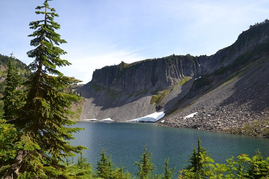
The most popular, and for good reason, is the Chain Lakes Loop, a moderate 9-mile loop that takes you behind Table Mountain to Mazama, Iceberg, and Hayes Lakes—all great options for a relaxing break. With wide-open vistas the entire way and only one steep section of hiking, this is a great walk for people wary of forested slogs uphill, like many of the hikes closer to Vancouver.
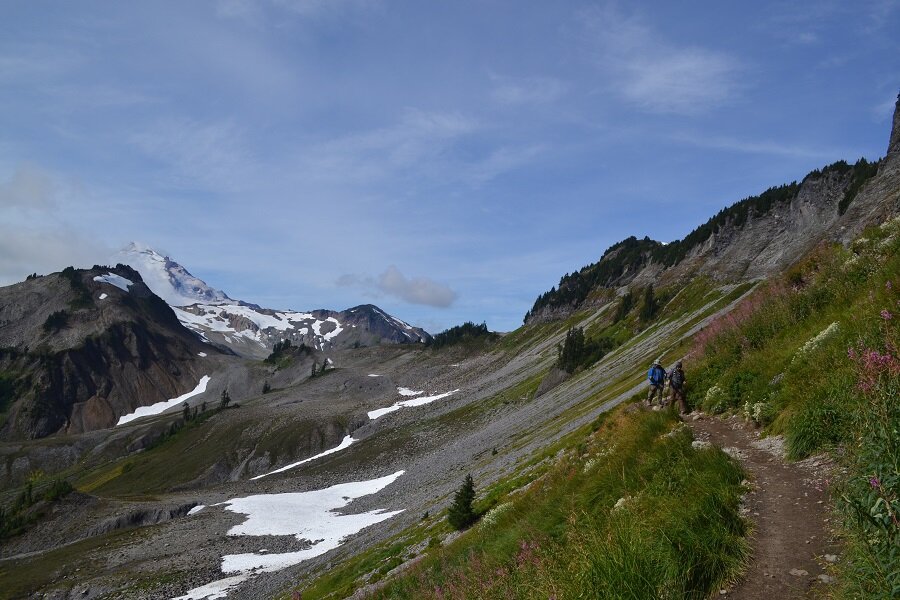
For a more strenuous trail that heads towards the grand peak of Baker, a side trail that veers off the Chain Lakes Loop will take you up and across Ptarmigan Ridge, an access route for intrepid climbers of the towering volcano. It’s a 9-mile out-and-back from the parking lot, but well worth the double-take.
For an up-close and personal day with Shuksan, head up the Lake Ann Trail, an 8.5 mile out-and-back. It’s a testing hike, but lovely. Rest by the lake, and try not to be intimidated by the towering pinnacles and hanging glaciers above.
For shorter, easier adventures, Artist’s Point is the launching area for the Artist’s Ridge Trail (2 miles) and the steeper Table Mountain hike (3 miles). The Heather Meadows Visitors Centre, a couple kilometers below Artist’s Point, also has a number of shorter, easier hikes, with the Bagley Lakes Trail (2 miles), the Wild Goose Trail (1.5 miles), and the wonderfully named Fire and Ice Trail (0.5 miles).
It’s fall hiking time. That means crisp, cool air, beautiful colours, and the last chance to get up high before the heavy snows cover the ground for another couple seasons.
You could make yet another trip up the busy corridor to Squamish and Whistler. Or you could spend a day on the North Shore kicking roots up a wall for that one great view. Or, pack a bag, fill the tank, and head south. It’s worth it.
It’s a giant volcano.
By KURT JOHNSTON